Site plans
Building footprint and exterior site context drawings for review, coordination, and supporting applications.
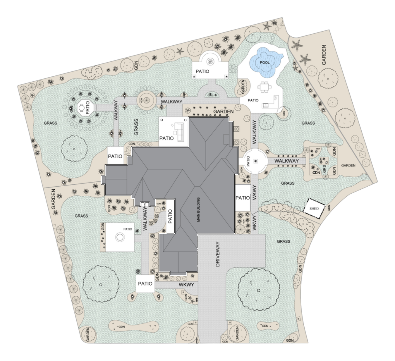
Site context drawings that clarify how the building is positioned.
This service documents the visible site layout around the building so teams can evaluate access, circulation, and exterior constraints early. It is commonly used for landlord submissions, renovation planning, consultant markups, and application support packages where a clear existing-condition site reference is required.
What can be shown
Depending on scope, drawings can include footprint geometry, entrances, drive aisles, pedestrian paths, parking, decks/patios, fence lines, and other visible site elements needed for design decisions and reviews.
Important limitation
This deliverable is not a substitute for a legal survey. Where approvals depend on property limits, setbacks, easements, or certified elevations, those items must be verified against current survey and jurisdictional requirements.